
La Graciosa on foot: Hiking through volcanoes, beaches and sandy tracks
La Graciosa is a hiker’s island. Not in the sense of signposted mountain trails with refuges and mountain restaurants – but in the sense of an island that you can only truly appreciate on foot. No tarmac outside the village, no tourist buses, no guided groups. Just sandy tracks, volcanic cones, the Atlantic breeze and a silence that unfolds with every step.
Walks, tips and all the tour information for La Graciosa
The network of walking trails covers approx. 30 km of sandy tracks through volcanic landscapes, along coastal cliffs and across dune fields. Four main routes cover the entire island – from easy beach walks to the challenging grand tour of the north coast.
Dolphins, Sundowner, Atlantic – the Sunset Catamaran Tour
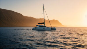
Dolphins, Sundowner, Atlantic – the Sunset Catamaran Tour Katamaran in der Meerenge el Río Imagine: a catamaran leaving the harbour of Caleta del Sebo just before sunset. The west coast of La Graciosa slowly passes by, the light turns golden, and then – a group of dolphins surfs in the…
Salty, Wide, Unique – Playa del Salado on the East of La Graciosa
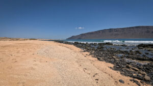
Salty, vast, unique – Playa del Salado in the east of La Graciosa Laguna del Salado on the island of La Graciosa Playa del Saladothe largest beach on La Graciosa – and the most secluded. It is east of the island far from the tourist hustle and bustle, with a…
Small Steps, Big Island – Hiking with Children on La Graciosa
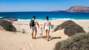
Small steps, big island – hiking with children on La Graciosa Hiking with children on La Graciosa La Graciosa is not a typical family holiday destination with a water park and children’s entertainment. And that is precisely what makes it so special for families. Sandy tracks instead of tarmac, fishing…
The Unknown East – Walk to Playa del Salado
The Unknown East – A stroll to Playa del Salado A walk along Playa del Salado Playa del Saladosalty, windy, secluded. A beach to the east of La Graciosa– a beach hardly anyone knows about, as everyone simply walks past it. And that is precisely why it is so special.…
Gold, Orange, Atlantic – Sunset Hike on La Graciosa
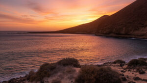
Gold, Orange, Atlantic – Sunset hike on La Graciosa Sunset hike on La Graciosa La Graciosa at sunset is something else entirely. The Atlantic turns orange, the silhouettes of Montaña Clara and Alegranza turn black against the sky, and the beach is suddenly deserted. If you know the right vantage…
Lava, Sand and Underwater World – Hiking & Snorkelling on La Graciosa
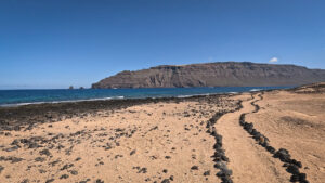
Lava, Sand und Unterwasserwelt – Wandern & Snorkelling on La Graciosa Hiking trail with views of the Famara Reef La Graciosa offers both: spectacular hiking trails and an underwater world that is among the most biodiverse in the Canary Islands. Combining the two is an obvious choice – and well…
No Signal, No Problem – The Best Hiking Apps for La Graciosa
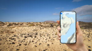
No mobile signal, no problem – the best hiking apps for La Graciosa Out and about on La Graciosa with an offline map and a hiking app La Graciosano tarmac roads beyond the village limits, no signposted trails, and hardly any mobile signal outside Caleta del SeboWhat’s optional at other…
Sand, Silence, Atlantic – Beach Walk to Playa Francesa
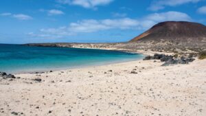
Sand, tranquillity, the Atlantic – a walk along the beach to Playa Francesa Playa Francesa bay with its fine sandy beach and Montaña Amarilla in the background Playa Francesathe most popular beach on La GraciosaFine white sand, crystal-clear water, the Famara massif on the horizon. Situated on the east coast…
Lace Up, Find the Horizon – Hiking on La Graciosa
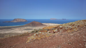
Lace up your boots, set your sights on the horizon – hiking on La Graciosa View from Agujas Chicas: Montaña Bermeja and the neighbouring islands of Montaña Clara, Alegranza and Roque del Oeste La Graciosa is not a traditional hiking destination. There’s no network of signposted trails, no mountain huts,…
Yellow, Wild, Unforgettable – Hike to Montaña Amarilla
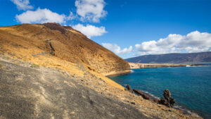
Yellow, wild, unforgettable – a hike to Montaña Amarilla Montaña Amarilla in the south of La Graciosa Montaña Amarilla – the yellow mountain. A volcanic cone made of tuff, glowing in shades of yellow, red and orange. The hike there is the picture-postcard view of La GraciosaAt its foot: the…
Red, Raw, Irresistible – Hike to Montaña Bermeja
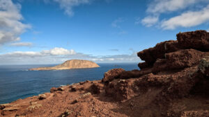
Red, rugged, irresistible – a hike to Montaña Bermeja View from Montaña Bermeja Montaña Bermeja (157 m) – the red mountain to the north of La GraciosaAt its foot: Playa de las Conchas – one of the most beautiful beaches in the Canary Islands. Standing up here, you can see…
Along the Strait – Coastal Path Caleta del Sebo to Pedro Barba
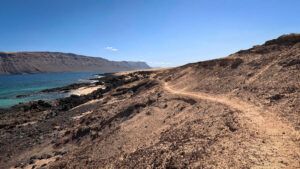
Along the strait – coastal path from Caleta del Sebo to Pedro Barba Coastal stretch between Caleta de Sebo and Pedro Barba Around 6 km, with little elevation gain, always with a view of the El Río strait in view – the narrow stretch of water between La Graciosa und…
All-Round Views – Panorama Loop around Montaña Pedro Barba
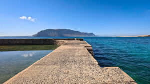
All-round views – panoramic loop around Montaña Pedro Barba View from the harbour at Pedro Barba towards the Famara Mountains A compact circular walk that takes in the north-east of La Graciosa from three sides: El Río to the east, Agujas Grandes (266 m) and Agujas Chicas (257 m) to…
Gentle, Clear, Breathtaking – Playa Francesa, La Graciosa’s Best Swimming Beach
Gentle, clear, idyllic – Playa Francesa, the best beach on La Graciosa Playa Francesa bay with Montaña Amarilla in the background Playa Francesa is the island’s favourite. Not because of Instagram – but because of everything that makes a good beach: calm, clear water, fine white sand, easy access by…
An overview of the four main walking routes
The Southern Circular Walk (11.2 km · 254 m elevation gain · moderate) is the island’s most popular route. It leads via Playa Francesa on the east coast to Playa de la Cocina at the foot of Montaña Amarilla (172 m) and back via the summit with its colourful tuff crater.
The Northern Island Circular Walk (19.3 km · 279 m elevation gain · challenging) is the centrepiece. It connects Pedro Barba, the Playa de las Conchas at the foot of Montaña Bermeja (157 m) and leads over the summit with its 360°-panorama back to Caleta del Sebo.
The East Coast Circuit (13.8 km · 108 m elevation gain · moderate) explores the secluded east coast: the gorge Barranco de los Conejos, the Morro Negro and the historic fishing village Pedro Barba in the north-east
The Montaña Amarilla beach walk (8.5 km · 321 m elevation gain · moderate) offers the most challenging summit experience: crossing a crater, a steep descent to Playa de la Cocina, return via Playa del Salado on the east coast.
Important information for hikers
All GPS tracks, elevation profiles and route descriptions: sunhikes.com
FAQ: Hiking routes, equipment & tips for La Graciosa
ROUTES & DIFFICULTY
There are four main hiking routes on La Graciosa: the Southern Loop (11.2 km · 254 m ascent · moderate), passing Montaña Amarilla and Playa de la Cocina; the Northern Island Loop (19.3 km · 279 m ascent · challenging), leading to Playa de las Conchas; the East Coast Loop (13.8 km · 108 m ascent · moderate), heading to Pedro Barba; and the Montaña Amarilla Coastal Hike (8.5 km · 321 m ascent · moderate), including a walk through the volcanic crater.
Three of the four main routes are rated moderate. None require technical climbing, but hikers should expect loose volcanic rock, sandy tracks, and strong midday sun. The Northern Island Loop is the island’s most demanding hike due to its distance. The easiest walk is the coastal path to Playa Francesa, a flat, family-friendly route that takes around 30–40 minutes from Caleta del Sebo.
No. There are no traditional signposted hiking trails on La Graciosa. Routes follow sandy tracks and volcanic terrain, and mobile phone coverage is very limited outside Caleta del Sebo. It’s highly recommended to download an offline GPS track before setting out.
EQUIPMENT & PREPARATION
The most important item is at least 2 liters of water per person, as there are no water fountains, kiosks, or shops along the trails. Wear sturdy hiking shoes or trail runners, since the terrain consists of loose volcanic rock. Bring sun protection, an offline GPS track, and plenty of snacks. Starting early in the morning is strongly recommended to avoid the intense midday heat.
Traditional guided hiking tours are generally not available on La Graciosa. Most visitors explore the island independently using GPS navigation. If you prefer assistance reaching more remote trailheads, you can hire a licensed jeep taxi, whose drivers know the island’s tracks and access points well.
HIGHLIGHTS & TIPS
It depends on what you’re looking for. For the most spectacular panoramic views, the Northern Island Loop is the top choice, featuring an ascent of Montaña Bermeja and breathtaking views over Playa de las Conchas and Montaña Clara. For the best combination of volcanic scenery and beautiful beaches, the Southern Loop via Montaña Amarilla with its descent to Playa de la Cocina is hard to beat.
Yes, but take extra precautions. During July and August, temperatures on the exposed sandy tracks can become very high. Start before 8:00 a.m., carry more water than usual, and consider choosing shorter routes or the coastal trail to Pedro Barba, which benefits from cooling breezes coming off the El Río channel.